


If you like to vacation on the water you are in the right place, as waterways make up nearly half of Iberia Parish. If you’re looking for a place to launch your boat or canoe, there are several public boat launches throughout the area.
And, with the Atchafalaya Basin as our backyard, the Bayou Teche Paddle Trail is a pristine area for reconnecting with nature while experiencing our vibrant culture.
We've compiled a list of water venues including places to stay on the water to help you plan your trip.
Atchafalaya National Heritage Area
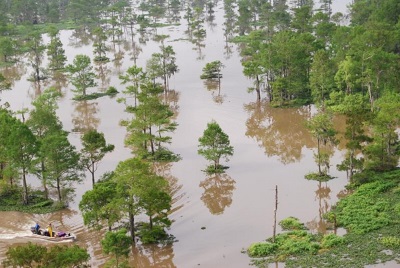
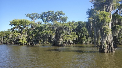
1. Atchafalaya Basin
The Atchafalaya Basin is the largest river swamp in the country. Referred to as "America's Foreign Country," the area is culturally rich with an ecologically varied region of rivers, bayous and swamps where fishing, boating and hunting opportunities abound. Over 85 species of fish, 200 species of birds, alligators and black bear share this unique ecosystem. The basin is bordered by levees and is approximately 150 miles in length, with its width varying along the course of the Atchafalaya river.
Docks:
- Atchafalaya Basin Levee (Ruiz Landing): Parish Rd. 305; 30.027489, -91.566936
- Atchafalaya Basin Levee (Sandy Cove): Parish Rd. 305; 29.968440, -91.542007
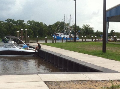
Twin Parish Port District & Port of Delcambre Facebook
2. Bayou Carlin (Delcambre)
Delcambre is a small seaport along Highway 14 linked to Lake Peigneur on Jefferson Island and the Gulf of Mexico by the Delcambre Canal (Bayou Carlin). The harbor provides ready access to the local waterways with a 28-slip marina at North Pier Marina and a four bay launch at Bayou Carlin Cove Boat Landing & Pavilion.
Dock:
- Bayou Carlin Cove - 605 S. Railroad St., Delcambre; 29.948295, -91.983244
See & do:
- Fishing
- View local shrimp boats
- Delcambre Direct Seafood marketplace
- Delcambre Seafood and Farmers Market
- Delcambre Shrimp Festival
- Christmas Boat Parade
Cabin on Bayou Petite Anse
3. Bayou Petite Anse (Avery Island)
Petite Anse means "Little Cove" in Louisiana French. This particular bayou runs along the west side of Avery Island before flowing south into Vermilion Bay and the Gulf of Mexico (through the Avery Canal). In the 19th century schooners regularly ascended the bayou to pick up loads of salt and sugar to transport to New Orleans or other ports as far away as New York. Bayou Petite Anse is still used today by recreational and commercial boaters seeking access to the Intracoastal Waterway and Vermilion Bay.
Dock:
- 6040 Avery Island Rd., New Iberia; 29.915546, -91.904052
See & Do
- Tabasco Factory Tours
- Restaurant 1868
- Jungle Gardens
- Fishing & Crabbing
Overnight: Cabin on Bayou Petite Anse
TECHE Project
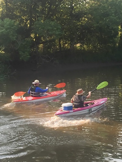
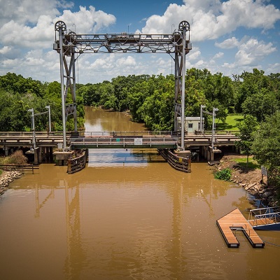
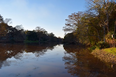
4. Bayou Teche National Paddle Trail (Loreauville to Jeanerette)
This 135 miles trail, which is part of the National Park Service’s National Water Trails System, offers multiple access points from Port Barre to Calumet. The Iberia parish portion starts in Loreauville through New Iberia (9.5 miles) and ends in Jeanerette (11 miles) with five boat docks located along the way.
Bayou Teche is a slow-moving waterway near the Atchafalaya Basin that is great for paddling. Oak, cypress, magnolia and redbud trees line the banks, and you may spot bald eagles, turtles, snakes, alligators, egrets and nutria. The bayou winds through history, snaking around the original grounds of the native Chitimacha people, and the New Iberia National Register Historic District, home to the Conrad Rice Mill (America’s oldest operating rice mill), antebellum plantation Shadows-on-the-Teche, and the Bayou Teche and Jeanerette museums.
Click to download your Bayou Teche Paddle Trail Guide and Bayou Teche Paddle Trail Maps. Print copies are also available at our welcome center.
Docks:
- Loreauville floating dock - 119 Bridge St., Loreauville; 30.056667, -91.740000
- PJ Allain Waterfront Park & Sculptural Garden dock: 109 N. Weeks St., New Iberia; 30.003012, -91.818266
- New Iberia floating dock - 108 Duperier Ave.; New Iberia; 30.00610, -91.816444
- New Iberia City Park boat ramp - 570 Marie St., New Iberia; 30.004073, -91.811736
- Jeanerette City Park floating dock & boat launch - 1603 Tarleton St., Jeanerette; 29.918926, -91.667089
See & do:
- Bayou Teche Museum, home of the George Rodrigue exhibit
- Shadows-on-the-Teche plantation home and gardens
- Conrad Rice Mill/Konriko Company Store, the oldest rice mill still in operation in the country
- Jeanerette Museum with its sugar industry exhibit
- New Iberia National Register Historic District
- James Lee Burke's Iberia Trail
- Main festivals include Bayou Mardi Gras, Books Along the Teche Literary Festival, Louisiana Sugar Cane Festival and the World Championship Gumbo Cookoff
- Paddling events: Tour du Teche and Acadiana Dragon Boat Races
Overnight in New Iberia:
- Bayou Chateau
- Bayou Gem
- Bayou House
- Bayou Teche Guest Cottage
- Chateau Royale
- Olive Branch Cottages
- Teche Motel
- Tensas Tower
Overnight in Jeanerette:
Lake Fausse Pointe State Park Facebook
5. Lake Fausse Pointe (Jeanerette, Loreauville & St. Martinville)
Though named as two separate lakes, Lake Fausse Pointe and Lake Dauterive (north of Lake Fausse Pointe) function as one natural body of water about 25 miles southeast of Lafayette in the Teche-Vermillion basin.
The 6,000-acre Lake Fausse Pointe State Park—bound on the east by the Basin levee and on the west by the natural levee of Bayou Teche—provides visitors with a chance to see and experience this isolated Louisiana swamp and its 1,000-year-old large bald cypress trees via numerous boardwalks and walking trails. In addition, exploring the lake by canoe or kayak on the canor trail offers a glimpse of what the region looked like thousands of years ago (kayak rentals are available on site).
Overnight visitors can "rough it" in the campground or stay in lake-front cabins.
Docks:
- Lake Dauterive: 5700 Lake Dauterive Rd., New Iberia; 30.080551, -91.650331
- Lake Fausse Pointe State Park: 5400 Levee Rd., St. Martinville; 30.06213, -91.610296 (boat and canoe rentals available)
- Marshfield: 3414 Marshfield Rd, New Iberia; 30.024804, -91.673012
- Jeanerette Canal: 11609 Jeanerrette Canal Rd., Jeanerette; 29.570000, -91.378000
See & Do:
- Fishing
- Nature Trails, Birding & Wildlife Viewing
- Mardi Gras Parade
Overnight:
- Lake Fausse Pointe State Park - camp sites and cabins
6. Bayou Patout (Weeks Island)
Paddlers can follow a 12-mile loop starting at the boat ramp of Patou Bayou landing and heading to the right. Bayous vary in size from several hundred feet wide to only a couple of boat lengths wide. Route takes you just north of Weeks Island and the Shell oil field. Tidal variations in the area may expose many mudflats that add to the area's interest.
Bayou Patout gives boaters access to Bayou Carlin and Weeks Bay in the Gulf of Mexico.
Dock:
- 7809 Weeks Island Rd./Hwy. 83, New Iberia (.5 miles from bridge); 29.836661, -91.790214
Port of Iberia
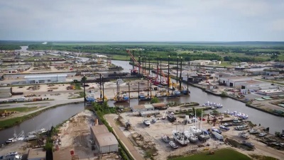
7. Port of Iberia (New Iberia)
Located near the Louisiana coast between New Orleans and Houston, the Port of Iberia has access to the Gulf Intracoastal Waterway and the Gulf of Mexico through its own Commercial Canal and has access to the Mississippi River through major ports in Baton Rouge and New Orleans.
The public dock facility offers both long-term and short-term docking services including electric power, water, security lighting and fencing, restrooms and parking. The marina offers 22 boat slips, both covered and uncovered for recreational and commercial vessels. Short-term moorings are available.
Dock:
- 4611 S. Lewis St., New Iberia; 29.944451, -91.836903
8. Spanish Lake (New Iberia)
Spanish Lake is believed to have been an oxbow lake of the Mississippi River when it flowed 3,800 to 5,500 years ago through what is now Bayou Teche. During Spanish rule of Louisiana, a large number of Canary Islanders and immigrants of Spanish descent moved into the area and settled along its shores, giving the lake its current name.
Dock:
- 117 Spanish Lake Rd., New Iberia; 30.044444, -91.862464
See & Do:
- Fishing (bait shop on site and five handicap-accessible fishing pier)
- Bird watching
- Walking trail
Cypremort Point State Park Facebook
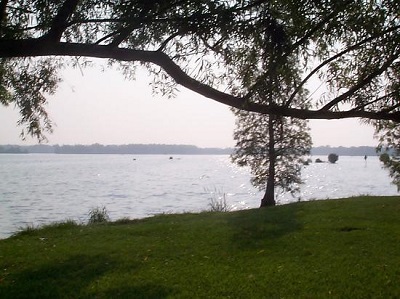
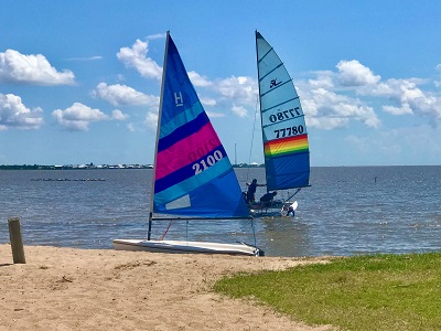
9. Vermilion Bay (Cypremort Point)
Between Grand Isle and Cameron, Cypremort Point is one of the very few locations near the Gulf of Mexico that can be reached by car. A half-mile stretch of a man-made beach provides a delightful area for relaxing, picnicking, kayaking and enjoying the water. A boat launch just outside the park's entrance is only a few miles from the Gulf of Mexico, and fishermen can venture out to fish in the Gulf or Vermilion Bay. Catches of flounder and redfish are not uncommon in the area.
For those interested in fishing from the shore, a 100-foot fishing pier is situated on the Bay. Overnight visitors also have access to adjacent boat docks and a fish cleaning station. Kayak rentals are available at the kayak launch.
Located in the heart of a Louisiana marsh, the site contains an abundance of wildlife. The quiet observer may happen upon nutria, muskrat, alligator or a number of bird species native to the state. Deer, black bear, rabbits, opossum and red fox also make their home in this area.
Docks:
- Cypremort Point State Park (beach and kayak launch): 306 Beach Ln., Cypremort Point; 29.736912, -91.853795
- Quintana (boat launch): corner of LA329 and Beach Ln., Cypremort Point; 29.731554, -91.840564
See & Do:
- Fishing & Crabbing
- Swimming
- Birding & Wildlife Viewing
- Mardi Gras Parade
- Gorgeous Sunsets on the Water
Overnight: Cypremort Point State Park - cabins and primitive camping sites
Resources
- Atchafalaya National Heritage Area
- Atchafalaya Water Heritage Trail
- Bayou Teche Experience (rentals and guides)
- Bayou Teche Scenic Byway
- Fishing and Charter Fishing in Iberia
- Louisiana Travel Paddle Trails
- Pack & Paddle (rentals, gear, classes and guides)
- Paddle the Gulf (map of all the Gulf Coast paddle trails)
- TECHE Project
- TRAIL


